
Maps
Please review the Montgomery County Internet Mapping Disclaimer prior to viewing map services, or the map gallery.
Map Gallery

Montgomery County Government Map Gallery
The Map Gallery consists of GIS map compositions that have been converted to GIF, JPEG, and Adobe (PDF) images for web access. Users can browse, display, download, or print a high quality map. The maps are grouped by department or subject.
The Map Gallery consists of GIS map compositions that have been converted to GIF, JPEG, and Adobe (PDF) images for web access. Users can browse, display, download, or print a high quality map. The maps are grouped by department or subject.
Story Maps
Map Viewers developed based on the ESRI ArcGIS Online "Story Map" template.
 2017 Farm Tour Map (Accessible Map)
 Historic Sites Tour Map (Accessible Map)
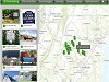
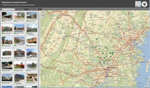 MC Pools, Senior Centers & Recreation Centers (Accessible Maps for Pools, Senior Centers, or Recreation Centers)
Other Map Services
Montgomery County, Maryland - Other Agencies
- Montgomery County Planning Commission MCATLAS
- Montgomery County Public Schools School Assignment Locator
- Montgomery County Public Schools School Service Area Maps
- Montgomery County Public Schools Maps
- Washington Suburban Sanitary Commission (WSSC) Water and Sewer
Washington DC Metropolitan Area
- Arlington County, Virginia
- Coordinated Highways Action Response Team (CHART)
- Fairfax County, Virginia GIS - On-line Products and Services
- Prince William County, Virginia Mapper and Demographic Mapper
- University of Maryland's Earth Science Data Interface
Federal Government