See more in Projects
Wireless Forestry: A Data Collection Model
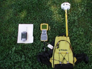
The Department of Technology Services - Geographic Information Systems (DTS-GIS) and the Department of Environmental Protection conducted a study in July/August 2001 to develop and test field survey methods for collecting and validating data using traditional data collection methods, hand-held computers with Geographic Information System (GIS) software and Global Positioning System (GPS) technologies. As a result, the hand-held GIS was determined to be the most scalable, affordable, and easy to use solution because it minimized inventory data-entry errors, reduced post-processing time, and produced accurate base-map quality surveys.
For more information regarding the study, please refer to the following Power Point presentation:
Wireless Forestry: A Data Collection Model (8,963kb). This was presented at the National Urban Forestry Conference in Washington D.C. on September 7, 2001.