Stormwater Management
Polluted runoff (commonly called stormwater runoff) carries pollution and trash as it flows into our streams, lakes, ponds and rivers, making them unhealthy.
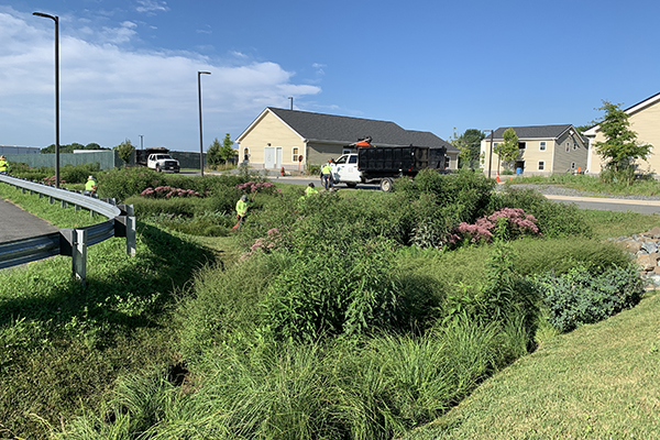
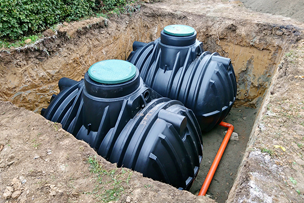
Stormwater Management is the process where we slow, store, or allow stormwater to soak into the ground to help reduce the amount of pollution entering our waterways. Montgomery County uses above and below ground structures (we call them stormwater management facilities) to remove pollutants from the stormwater before the water gets to streams.
Is there a Stormwater Management Facility in my property?
The interactive stormwater facilities map shows all of the County's stormwater facilities.
Search by address to see what is on your property. The colored dots represent different types of stormwater facilities. Clicking on a dot will reveal that particular facility type. Look for your property on the map!
Accessible Map: Stormwater Facilities Accessible Map
What Does the Stormwater Maintenance and Inspection Program Do?
What Does the Stormwater Maintenance and Inspection Program Do? The Stormwater Maintenance and Inspection Program is responsible for inspecting and ensuring the maintenance of all public and private stormwater management facilities within Montgomery County (excluding the municipalities of the City of Rockville, Gaithersburg, and Takoma Park). This includes ponds, levees, bioretention, underground facilities and Environmental Site Design (ESD) practices throughout the county. The program manages the structural and nonstructural maintenance of these facilities/practices on county owned property or that have been transferred to county maintenance using inspection and maintenance contractors. This also includes the Dam Safety Program.
The program is paid for by the Water Quality Protection Charge (WQPC). The WQPC is a part of Montgomery County property tax bills and it raises funds to improve the water quality of our streams and reduce the impacts of stormwater runoff. There are many things that property owners can do to reduce and prevent stormwater. Learn more >>
Quick Links:
Multimedia
Part 1 - How does it work?
Part 2 – Bioretention Planting Designs
Part 3 – Bioretention plants
Stormwater Facilities Map
The interactive map shows all of the County's stormwater facilities.
Search by address to see what is on your property. The colored dots represent different types of stormwater facilities. Clicking on a dot will reveal that particular facility type.
Accessible Map: Stormwater Facilities Accessible Map
Dam Safety Program
Montgomery County is subject to Maryland Department of the Environment (MDE) regulations regarding Dam Safety. There are 16 state “classified” high hazard dams and 15 significant hazard dams in the County, of which, it is responsible for safety regulations such as routine maintenance and emergency response at eight dams and two levees. Each of those facilities has an Emergency Action Plan. The 21 remaining dams are privately owned and maintained by the property owners. Many dams are part of stormwater facilities.
During heavy rainfall events, you may see county staff out inspecting the dams and monitoring the water levels. These individuals serve an important role in the Emergency Action Plan. Observing the condition of the dam in live time, they provide critical information to the engineers and officials who initiate the appropriate level of response outlined in the EAP for each facility.


